PRAMODYA GROUP

Pramodya Group is a visionary firm with over twenty five years of outstanding experience in the domains of land surveying, infrastructure development, and facility services, delivering innovative and precise solutions across India’s evolving development landscape. Established with a mission to provide technologically advanced and reliable services, the group has built a solid foundation through its three core verticals: Pramodya Digital Surveys, Pramodya Infrastructure Development, and Pramodya Facilities in Land Surveys.

Land Surveying Excellence

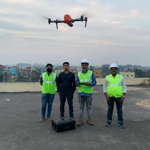
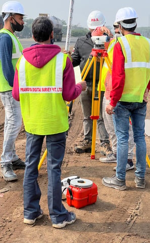
Land surveying is the foundation of every construction and development project. At Pramodya Digital Surveys, we specialize in using modern technologies such as Total Stations, DGPS (Differential Global Positioning Systems), 3D Laser Scanning, Drone Aerial Mapping, and GIS (Geographic Information Systems) to deliver high-accuracy survey data. Our work starts with site reconnaissance, followed by boundary surveys, topographic surveys, contour mapping, and layout marking.

We meticulously analyze terrain features, elevations, and natural or man-made obstructions to create precise digital maps and survey reports. This accurate groundwork is essential for designing layouts, estimating resources, minimizing project risk, and ensuring legal and regulatory compliance. From urban master planning to industrial site development, our survey teams ensure data precision, spatial analysis, and geo-referenced reporting for all land-based operations.

Infrastructure Development & Project Execution

Pramodya Infrastructure Development focuses on designing, constructing, and managing large-scale infrastructure projects with emphasis on durability, sustainability, and timely delivery. Our capabilities span across:

  • Airport Construction & Expansion
    Including runway layout, terminal planning, ground survey, and structural development with strict compliance to aviation norms.

  • Highway & Roadway Projects
    From land acquisition surveys to alignment design, grading, drainage systems, and asphalt or concrete pavement construction, we execute all phases with civil engineering precision.

  • Industrial Complexes & Smart Infrastructure
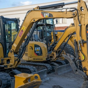
    Our team delivers turnkey development of industrial layouts, warehousing zones, and integrated utility infrastructure including sewage, electrical, and water systems.

Our projects undergo rigorous planning, structural analysis, design validation, material testing, and site management under qualified civil engineers, project managers, and architects. We incorporate environmental impact assessments (EIA) and follow safety regulations to ensure responsible and sustainable development. The use of BIM (Building Information Modeling) and AutoCAD Civil 3D enhances accuracy and reduces on-site errors.

Facilities in Land Surveying & Project Coordination

Pramodya Facilities in Land Surveys complements our other divisions by offering end-to-end support services, such as survey equipment rentals, data interpretation, legal documentation assistance, digital archiving, and project reporting. These services bridge the gap between survey outputs and project implementation, ensuring a smooth transition from planning to execution.

We also assist government and private clients in land demarcation, ownership mapping, revenue record correction, and compliance documentation for infrastructure approval and development clearance. Our facility team ensures that all survey data is transformed into usable project insights—paving the way for faster approvals and flawless construction alignment.

Leadership & Legacy

At the heart of Pramodya Group’s success is the strong leadership of Chairman Mr. Partho Sarathi Baidya and Director Mr. Soumodip Baidya. Their vision, integrity, and passion for excellence drive the team forward. They have played a key role in managing operations, client relations, and business expansion across various sectors.

Thanks to their strategic direction, the group has successfully completed numerous prestigious projects involving airports, highways, roadways, and industrial infrastructure—delivering premium results that meet the highest industry standards.

Our Promise

With a dedicated team of professionals, advanced equipment, and client-focused methodology, Pramodya Group continues to deliver projects that transform spaces, enable progress, and elevate industry benchmarks. We are committed to excellence, transparency, and continuous innovation in every aspect of our services.

As we look toward the future, Pramodya Group remains focused on expanding its legacy of quality and trust—creating infrastructure that supports economic growth and sustainable development for generations to come.

Innovative infrastructure projects that transform communities.
A tripod-mounted surveying instrument is prominently placed in the foreground, with a large construction site visible in the background. Tall cranes and unfinished buildings indicate ongoing construction work, set against a clear blue sky.
An aerial view of agricultural fields with a river cutting through the landscape. The fields are divided into rectangular patches, some covered with dark-colored materials, possibly solar panels or greenhouses. Several boats are visible on the river, suggesting transportation or trade activity. Infrastructure like roads and buildings are also visible, indicating human settlement and development.
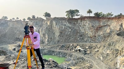
A surveyor's tripod with a total station is set up on a grassy hill overlooking a sprawling rural area with fields and industrial buildings. The sky is overcast, slightly obscuring the distant horizon, and there is a utility bag on the ground nearby.

Excellence in Land Surveys & Development

Pramodya Group specializes in premium land surveys and infrastructure development, ensuring quality and precision in every project. Discover our commitment to excellence and innovation in the industry.

Two construction workers are involved in infrastructure development beside a body of water. One worker is positioned on the edge of the embankment, wearing a helmet and an orange safety vest, preparing machinery. The other worker is on a floating platform, guiding or holding a large metal sheet beside tall reeds. Graffiti decorates the brick wall in the background, adding an urban element to the environment.

300+

Clients

Projects completed

500+

Premium Services Offered

Explore our exceptional services in land surveys, infrastructure development, and premium facilities tailored for you.

Aerial view of a newly constructed road with a roundabout in a development area. The site features patches of bare soil, concrete foundations, and partially constructed buildings. The surrounding land appears undeveloped, with empty plots of dirt and some green-covered sections indicating future construction.
An aerial view of a developing urban area featuring several high-rise buildings under construction. The surroundings include a network of roads, greenery, and scattered residential and commercial structures.
Land Surveys

Expert land survey services ensuring accuracy and reliability for all your surveying needs and projects.

Infrastructure Development

Transforming visions into reality with our innovative and high-quality infrastructure development projects and solutions.

Premium Projects

Explore our exceptional land surveys and infrastructure development projects.

An aerial view of a serene landscape featuring a river surrounded by patches of trees. Buildings and infrastructure are evident in the background, along with a bridge crossing the water. The land is a mix of grass and pathways, with sparse tree coverage and a generally open area.
Aerial view of a developing urban area with a mix of paved and dirt roads. Dense clusters of small, shanty-like structures are situated on either side of a main road, with several vehicles traveling along the roads. There is a rectangular pond or water feature in the foreground and multiple trees scattered throughout the area.
A large-scale construction site set in a partially cleared forest area, featuring winding dirt roads and an array of heavy machinery. The landscape is dominated by red-brown earth, with a linear structure running horizontally across the scene and several clusters of construction material.
A wide urban landscape featuring expansive infrastructure development, with a highway dividing the image. Modern buildings line one side, while construction is visible in the distance. Fluffy clouds are scattered across a deep blue sky, and vehicles are moving on the road.

Contact Us

An aerial view of a freshly paved intersection in a developing area. The roads are dark and new, bordered by sandy plots and neatly arranged sidewalks. A long shadow of a streetlight extends across the intersection.

Get in touch with Pramodya Group for premium land surveys and infrastructure development inquiries today.